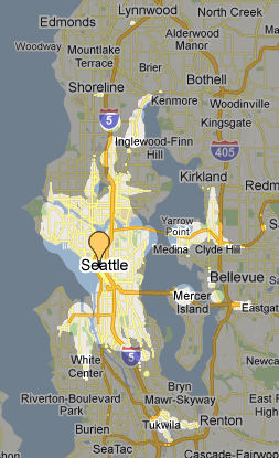
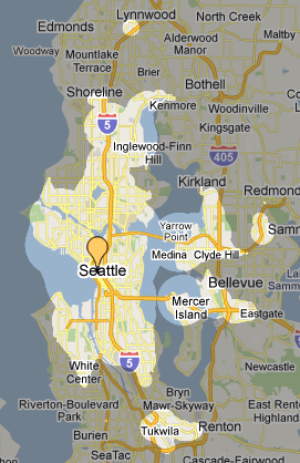
Mapnificent is the coolest. For those of you who thought you were going to get work done in the next half hour, I apologize.
Basically, Mapnificent shows you how far you can get from any given spot in the city using transit and walking (otherwise known as a walkshed map). See those little bubbles outside the main blob? Those are express bus and light rail stops. There is a button you can then click if you have a bike that calculates in that increased range.
The results are clearly theoretical and depend on buses being on time and don’t really seem to calculate hills or bike paths into it’s equations. And, of course, you can’t really ride your bike across a body of water, up a cliff face with no roads, etc. But it’s still fascinating to play with.
Here’s another experiment. How far can I get from Cal Anderson in 20 minutes using transit and walking on a Sunday?
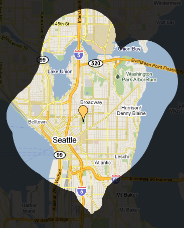 Perhaps this should be obvious, but the bike becomes that much more useful when transit is not running peak weekday service (indeed, you can imagine what this would look like if buses were not running at all).
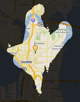
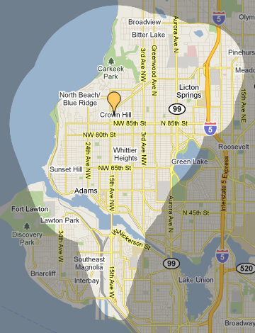
Okay, one more, then I’ll let y’all play around with it. How far can I get in 20 minutes if I live in Crown Hill and buses are on Sunday noontime schedule? Transit and walking:




Comments
5 responses to “Mapped: The advantage of the Seattle bike/bus combo”
Playing around with it yesterday really reinforced how constrained east-west travel is around here. And there is a similar caveat to a current shortcoming of walkscore.com: it appears to use as-the-crow-flies radius around transit stops, so it may be overly optimistic in the range when a stop is near a barrier (canal, river, I5, etc.).
But still, way cool!
Yeah, it’s a problem that Mapnificent thinks you can walk/bike on water. In your Cal Anderson example, that bit of Windermere that shows up in the bikeshed is only really accessible if you can ride across Union Bay. And the size of the bikeshed on the far side of Lake Union: is Mapnificent assuming you’re riding around the lake on roads, or riding straight across on the water? I assume other important geographic features—like hills—aren’t factored in either. Of course, it’s still a fantastic site. The results just have to be taken with a grain of salt.
Did you mean we would spend half hour rebooting after it crashed firefox. ;)
[…] to talk about bike/transit synergy, which is one of my favorite topics, so I’ll let Tom take it away. « ATU Approves Labor […]
It’s also important to note that it only contains data for King County Metro routes and the Sound Transit Express routes that Metro operates (522, 540, 545, 550, 554, 555/556, 560, 566, 577). None of the other Sound Transit routes or any Community Transit or Pierce Transit routes are included.