The new bike maps are here! The new bike maps are here!
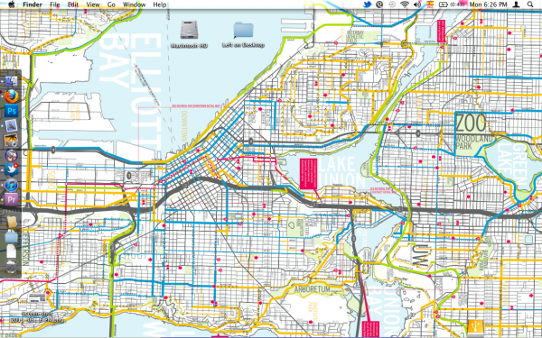
Here’s a good test of your bike lane nerdom. If you get super excited upon hearing that the city has released it’s annual bike map, which is almost identical to the map hanging on your wall except for a couple new lines indicating the bike facilities constructed in the last year, you are probably a bike infrastructure geek. But you have company. Here is a look at my computer’s desktop background:
 It’s not even a good desktop background. I can never find anything I leave on it. But I use it anyway, and I’m about to update it with the 2011 map (I can’t have a desktop wallpaper that’s missing the climbing lane on Jefferson!).
You can look at the map in the city’s handy online viewer or you can order a hard copy for free by filling out this online form (thank you, Bicycle Alliance!).
The city’s bike map has a sleek, easy-to-read design that was new in 2010. It is an excellent tool to find bike facilities and signed bike routes you may not have been aware of. It’s also very useful if you are going somewhere unfamiliar. The routes on the map are not always my favorite routes, but they are rarely dangerous and are dependable places to start until you can do some exploring to find the route you like best.
It does not appear Google has updated its bike map with the city’s 2010 projects yet. I wonder how long that will take. Should we be submitting reports to Google for each new feature as they come?


Comments
2 responses to “2011 Seattle bike map now available”
It’s not as smartphone friendly as it could be, but glad it’s in the world at all. Now, if the Google coders on Lake Union would either put the bike tab on the iPhone Google Map app or put out a stand stand-alone, that would be grand.
I informed Google of the Chief Sealth extension about two weeks ago and got the standard “you were right! We’ll update the map soon” response on the 10th. Probably can’t hurt to let them know of the other new facilities, though I don’t think I’ll add all of them myself—I’ll leave some for others. Or at least for tomorrow :)
If they rely on the DOT for GIS data, I guess it might not make much difference to report new facilities, since maybe they’ll still just wait for the latest batch of data from the City. But, who knows, maybe they can click in a provisional route, or send a Google Maps trike down there to collect its own data. At the very least, reporting them can’t hurt.