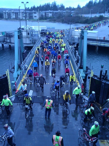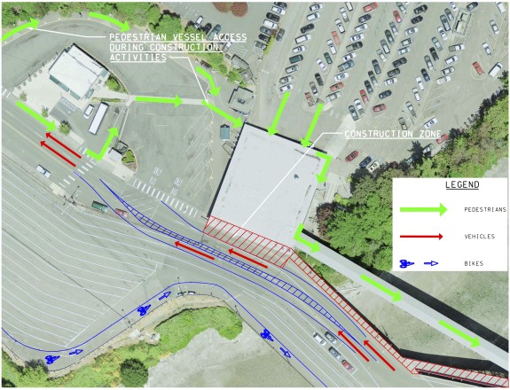
People who bike to and from Bainbridge should be ready for some changes and narrower lanes at the island’s ferry terminal starting Monday, Cascade Bicycle Club notes on its blog:
Construction will take place from 9 a.m. to 5 p.m. daily, and the lane closures will last about a month while the terminal undergoes renovations.
There have been several accidents involving bicyclists at the Bainbridge Island Terminal recently, so remember to be extra cautious and take it slow when boarding and disembarking.
— Advertisement —
Ferry folks urge people on bikes to use the bike lanes whenever possible, and not just for safety. I have often wondered why the bike lane heading to the ferry goes all the way around the line of often empty toll booths. Why shouldn’t I just ride through the empty toll lanes?
Because you trigger the car counter and screw up the ferry’s counts, resulting in “an administrative headache for some really nice folks,” as Cascade put it. I had no idea. So don’t take a short cut through the toll booths.
Here’s a map of the construction reroutes:


Comments
11 responses to “Cascade: Bainbridge ferry terminal construction could bring cycling headaches”
A car detector that works for bikes? Can we get this on Seattle street lights?
FTW
Certainly.
In fact, SDOT has already installed them at nearly every single intersection in the city.
And they all work, except when they don’t.
This would be a good time to plug the city’s Find It Fix It app: http://www.seattlebikeblog.com/2013/09/11/how-you-can-help-the-city-fix-road-hazards/
Use it to report all signals that don’t detect bikes. They really do respond to these requests.
I would say “many” instead of “nearly every”.
I didn’t know until recently, when a Seattle maintenance worker pointed it out to me, that there are a lot of traffic lights with sensors that are designed to work with bikes. Look for a small “T” on the edge of the sensor loop, about 6 inches wide and tall. This picture shows an example, though most of them are not spray paint, but some solid marking.
*Why* does SDOT continue using these obscure “T” markings more than a decade after a much clearer national standard was adopted?
There are sensors that are sophisticated enough that they can detect what type of vehicle is above it. Maybe someday they can get a one that can count both bikes and cars and give them a number of each of those types.
I understand that bikes boarding the ferry are supposed to use the bike lane along the southwest side of the loading lanes, but are there any changes for bikes riding off of the ferry? WSDOT’s map doesn’t seem to provide any guidance.
hello everyone in seattle. hope someone reads this. looking for some info. im vacationing in your city this summer. would like to get some feedback from local cyclists. I want to take one of you ferries out to an island with my bike for a simple day ride, and return same day. would also like to park somewhere in the spaceneedle area. I will do this during a weekday ie Wednesday or Thursday. any suggestions which ferry to which island. really appreciate any in put.