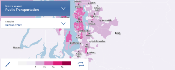
The new Census commute data visualization tool is awesome. The data is not new. It’s the same dataset we analyzed last fall when we discovered that fewer than half of Seattle residents drives alone to work. But the new visualization tool is super cool and easy to use. Give it a try!
Here are some maps from Seattle:
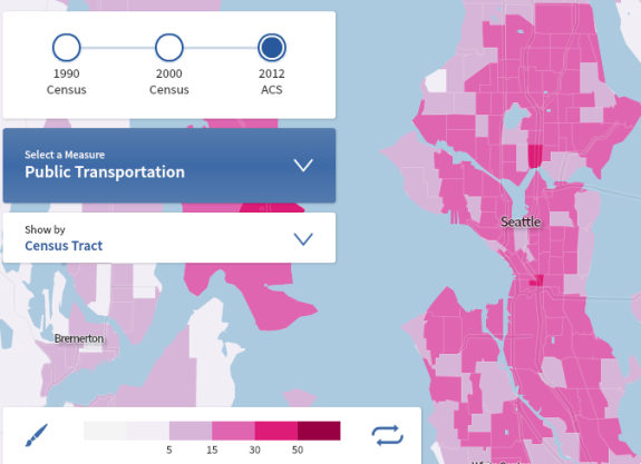
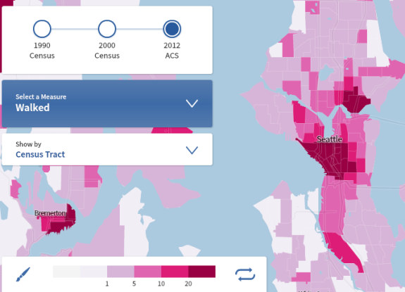
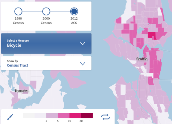
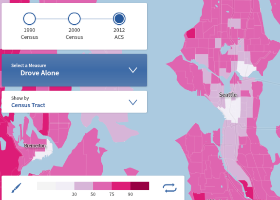 And remember how King County Prop 1 failed, thus dooming transit service to awful, terrible cuts? Well, here’s a look at county commute data:
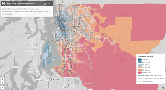
And here’s the vote on Prop 1, courtesy an awesome interactive map by Oran Viriyincy:
So, basically, if you use transit (or if your neighbors do), then you probably voted for Prop 1. So the best way to get more people to vote for the next county-wide transit measure is to get more people using transit! Too bad the failure of Prop 1 means awful transit cuts, at least outside of Seattle (which has plans to save its own service).
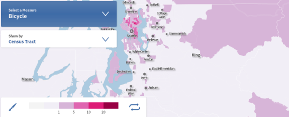
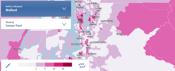
Here’s where people in King County bike or walk to work:
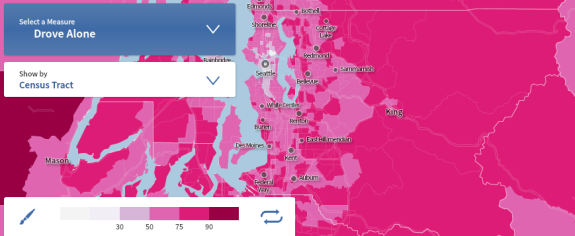
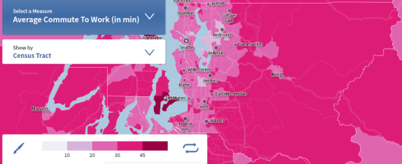
And here’s something really fascinating: Check out the correlation between driving alone and commute time in King County:
Notice anything else interesting in the data? Let us know in the comments.



Comments
5 responses to “Where people walk, bike, take transit and drive alone in Seattle and King County”
If drivers actually had to pay what it costs to drive we would see a lot less of those SOV’s on the road. I’m personally tired of subsidizing other people’s laziness.
Unfortunately, those people probably feel the same about subsidizing non-drivers, ignoring the fact that cars are also significantly subsidized.
[…] maps are back: Curious about biking, walking, and transit use in the Puget Sound? Take a peek at this impressive set of Census information over the past 20 years. D.C. is making us look bad, they’ve got 250 miles of BRT and rail […]
Subsidy for Cars:
Lanes, meters, curbs, paving–along with pot holes and other repairs.
Parking lots that may have a higher and better use.
Traffic cops, meter maids, helicopters that watch traffic pile up and report it.
Oil/Gas subsidies from Feds & State
Our health–burning fossil fuels emits known toxics into the atmosphere that all us breathe in with the passing of each vehicle . If we get sick, the car owner’s that emit the toxics are not held liable.
You may have more…
[…] such a dense neighborhood so close to downtown, nearly all First Hill residents walk, bike or take transit most often to get around. This presents a great […]