UPDATE: Shortly after posting, Cascade Bicycle Club announced the formation of the Eastside Greenway Alliance, a group of seven organizations that will “will dedicate time and resources to move forward with the goal of a multi-use corridor that will provide our greater Eastside community with wide ranging benefits from improved mobility and public health to economic development and a decreased carbon footprint. Through community engagement, fundraising and advocacy, the Eastside Greenway Alliance will advance the multi-use development of the Eastside Rail Corridor.”
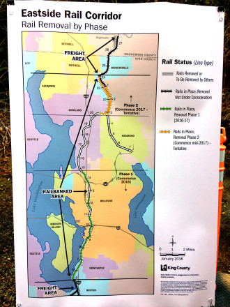 The rails are coming out. King County Executive Dow Constantine removed the ceremonial first rail spike Friday, a major step in developing the most important stretch of regional trail since the Burke-Gilman.
The work to remove the rails south of Kirkland will continue through 2016 and into 2017, funded by the scrap value of the steel rails themselves.
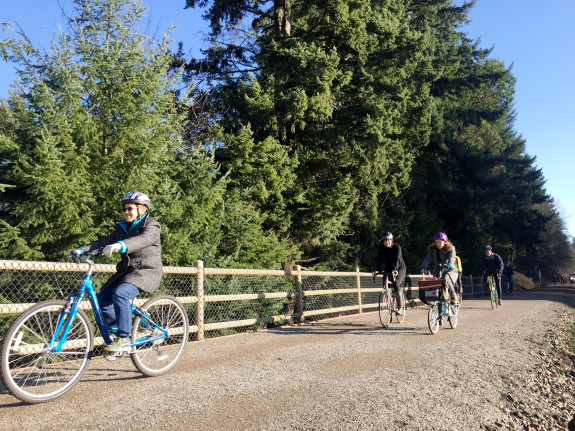
It will still take more work after rail removal before the trail will be easily bikeable. The existing railbed needs an upgrade to hardpack gravel — like the existing Cross Kirkland Corridor section — before it will be easily usable by bikes not designed for offroading. The busy street crossings will also need upgrades.
The exact timeline for when you will be able to bike on the trail is not yet clear, but a King County press release says the section connecting to Kirkland’s trail will be first:
It is expected rail removal will begin at the ERC segment south of Kirkland, which has already removed rail and developed a trail through its portion of the corridor. It is likely King County would begin developing an interim gravel trail at that location, extending the length of usable trail within the corridor.
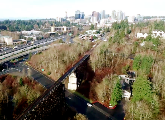
But the real eye-opening section will likely be this incredible high trestle in Bellevue, captured in a short drone video by King County:
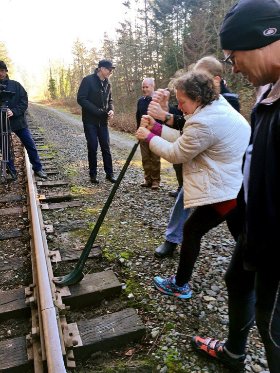
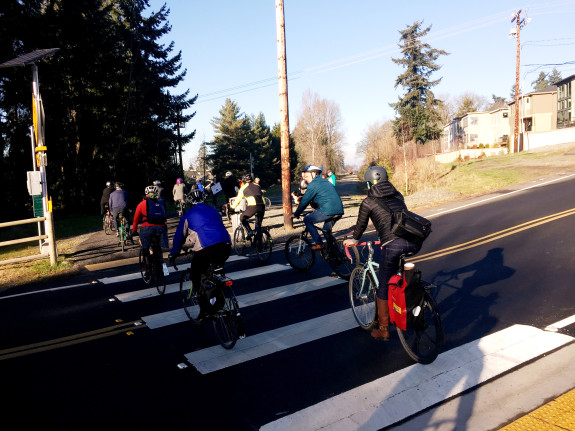
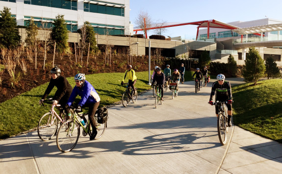
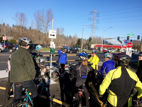
After Friday’s ceremony, a group led by Cascade Bicycle Club went on a ride along the Cross Kirkland Corridor to learn about what the city has been doing to take advantage of the trail as a way to connect neighborhoods, schools, parks and employment centers.
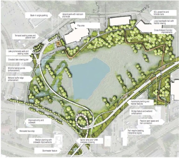
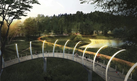
 We also learned about the city’s remarkable plans to connect the trail to Totem Lake, which will get a new park and serve as a major trail hub with connections to the future Redmond Connector and the Sammamish River Trail. Today, the massive intersection of NE 124th St and 124th Ave NE serves as essentially a trail dead end. But the city has funding to design a trail overpass that could be a wonder of its own.
From the CKC Master Plan:
 There’s a whole lot of funding and work left to do, but the Eastside Trail is clearly on the right track. Now let’s just see how quickly we can get all the pieces together, because I can’t wait to ride it and see how it transforms Eastside communities.



Comments
23 responses to “The Bellevue section of the Eastside Trail is going to be unreal”
With the Wilberton tunnel ROW gone, or rather replaced by I-405, I’m wondering how they plan to get us from the trestle to the trail along Lake Washington.
When this thing is done, it will be a great access from Renton to Bothell. The next connector is to get the bits North of Bothell to connect. I would love to be able to ride all the way North to Bellingham on a bike ROW. Think of the tourist attraction that would be, to have a dedicated route from Vancouver BC to Vancouver WA.
There was some great discussion at the Eastside Rail Corridor Summit about “completing the loop”, as in connecting the trail through Renton to Duwamish, the Interurban, and up to Seward Park and beyond. An exciting idea, especially for Renton and Cedar River Trail connections.
From Renton to the Interurban Trail at Tukwila as a Rail With Trail would be good idea, I have not heard any planning for this however. SE 7th is the only link now but not very bike friendly!
Renton has been less bike friendly along the Cedar river trail than I would like. The current connection from the West side to the East side has a difficult at surface crossing at the library, or a “walk your bike” along the trail underpass at both ends. At the Western edge, the trail is very narrow which makes sense as any sort of speed endangers pedestrians, but the other side, is just plain poor visibility.
The alternative, to connect to the access road along Renton’s airport is blocked by Boeing’s “our employees and planes” only bridge. You used to be able to cross there, but no more.
The Regional Open Space Strategy that is emerging out of the UW Dept of Landscape Architecture Green Futures Lab envisions the links Lisa and others have proposed. The connection across Renton to the Interurban and Green River Trails (and also along Rainier Ave into Seattle) is of particular interest. Expensive and difficult but key to a regional system and worthy of regional resources. Keep up the lobbying.
I’d really prefer an underpass at 124th Ave. The height clearance for bikes is much lower than for trucks, which means much less climbing, which means more people able to use the crossing more easily. Granted, the view from the bridge looks outstanding!
They’re planning long approaches to keep the grade easy. And yeah, they’re aiming to design a crossing that not only works, but also becomes an attraction of its own.
That’s good. The current ped/bike overpasses in Kirkland (over 405, so much higher) are almost unusably steep. I kick my mobile cargo off the bike to use them, even with a stokemonkey.
Long approaches are good for bikes, but not so good for walkers, as they needlessly increase the distance one must travel. Walkers can easily go up or down a flight of stairs, but I don’t see any stairway-cutoffs in the plans.
One issue with underpasses in the Totem Lake area is that there are a lot of drainage issues there. So I’m not sure you couldn’t trust an underpass not to flood regularly. It used to flood over Totem Lake Blvd on a fairly regular basis until recently.
But I do have mixed feelings about that overlook structure at the lake. It looks very cool and it’ll be a great attraction. But it’s a lot of loops to go around for somebody who just wants to get from A to B.
Hopefully there’s some kind of dedicated and unobstructed view of the Bellevue skyline on the trail.
A few years ago I walked the corridor down to a bit south of 24th NE. In that area, and probably the areas closest to downtown Bellevue, it’s fairly low-lying, generally below the street network. It’s also surrounded by trees. Prospects are probably better a bit to the south, on the hillside around 1st Ave SE and on the trestle.
Exciting news, but the at-grade crossing at NE 8th in Bellevue will be a challenge. It could also be a real opportunity to make that ugly parking lot/industrial area around Lake Bellevue into something much nicer.
There’s a light rail station going in along the corridor, just north of NE 8th. If I recall correctly Sound Transit designs incorporate the crossing of NE 8th.
There’s also Bellevue’s 120th Ave NE widening just east of there. A wider 120th is not so great, but they’re adding bike lanes and making the intersections of 120th, Bel-Red Road, and NE 8th less crazy. 8th itself, of course, is still a terrible bike and pedestrian route because of the dreaded cloverleaf. I don’t know that there’s a cloverleaf interchange involving a non-freeway road anywhere in the world that isn’t a mistake…
There’s a new grant out for rails to trails projects: http://www.railstotrails.org/our-work/doppelt-family-trail-development-fund/?utm_content=0db67e2948792fa6ea09a24a36c78476&utm_campaign=ENews160111&utm_source=Robly.com&utm_medium=email
Heh, this is a grant with awards in the $10,000 range. Based on what we’re paying consultants to master-plan the CKC, I don’t think we could write a grant proposal that cheap here.
It really puts this whole thing into perspective. Bike infrastructure can be built quickly, for rather little money. When the corridor is just handed to you with major road crossings grade-separated already it doesn’t even require too much design. Grants in this range can accomplish a lot! But here we insist on doing everything slowly and expensively. It’s almost like a curse of riches.
Pretty exciting.
I wonder how the folks working to keep the John Wayne Trail open could get some of the money??
the money that seems to be available. Most of it is federal yes?
[…] to be unreal: Tom over at Seattle Bike Blog hails the coming changes from the rail-to-trail corridor on the […]
[…] is much excitement about the trail in progress on the Eastside Rail Corridor and its potential to transform […]
This saddens me greatly.
I support both bike and rail and was hoping to see an Eastside commuter line along that corridor.
In the end we will be given a hefty package to build other rail corridors and purchase rights of way.
So much for multimodal options.
I rode from Lake City to the North Trailhead via Burke-Gilman into Sammamish River trail, took a right and climbed 124th.
So overall I think the trail is nice, I do ride a dual suspension mountain bike, but I’d say it should be doable with a hybrid bicycle. Road bikes, I’d say check with the manufacturer / bike shops to see if the skinny tires are ok on finely crushed gravel.
What I think of the scenery: it’s somewhat typical industrial left & right since it was a train track in the past, but also some nice scenery peekaboo Lake Washington closer towards the end of the trail. There were at least 3 – 4 stop signs for the bicycle, they were a little disjointed (minor pet peeve, but probably to deter bicyclists from blowing right through the junction), and those stops had a fast responding orange blinking pedestrian crossing and drivers were nice enough to slowdown and stop and knew that it’s part of the trail crossing.
It feels similar to the trail at AT&T Bothell WA located at the Bothell Technology Park area, and at times it also felt like Burke GIlman but with finely crushed gravel especially when the trial is elevated and you cross a wooden bridge. I only saw 2 – 3 bicyclists on the trail, the rest were people walking else jogging.
Looking froward, it would be great to see it completed and connected with the missing parts and it would serve as an alternative to Sammamish River Trail, not that it is a bad trail, and can be more focused towards the Bellevue / Kirkland side since Sammamish River Trail is more towards Redmond side and into Marymoor park & to loop Lake Sammamish itself.
[…] county has already started construction on an interim trail in the north end of Bellevue, connecting to the already open Cross-Kirkland […]