EDITOR’S NOTE: Aviva Stephens is a Seattle native and financial professional who discovered the benefits and joys of cycling on her challenging work commute between Ballard and the Eastside. Find more of her writing on Medium and follow her on Instagram at @avivarachelle.
Since bike commuting to and from the Eastside, I have been eagerly awaiting the opening of the new 520 Bridge trail. After years of sitting in traffic due to car accidents, unexpected congestion, and inclement weather, I could not wait to fly past the parking lot of cars on my bike with smile on my face.
The beginning
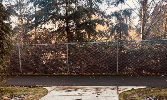
I took the afternoon off December 20 (opening day of the 520 Bridge trail) to enjoy every moment of my glorious ride during what little daylight there was. Fortunately, the 520 bike trail runs right past my office. Below is a pic of the trailhead, SR 520 is just beyond the trees. If you’ve never been on the trail, it mostly runs alongside SR 520. If not, you’ve likely noticed a few sparse bike riders to your right while driving eastbound on the highway.
While I’ve ridden parts of this trail around Redmond, I’ve never taken it all the way to the bridge. So this was an adventure for me. Like many folks who have been waiting for this day, I figured the trail would run along 520 all the way into Seattle. It is called the “520 Trail” after all, right? Not so much. The trail does follow the freeway for the most part, but there are some confusing breaks that can make this ride challenging. In this post I will share my experience with the breaks and offer tips if you look to make the same journey.
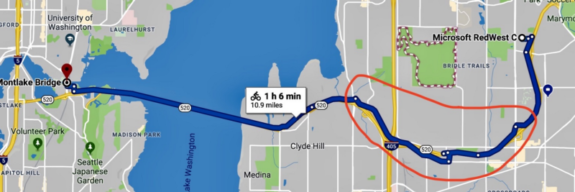
The circled section below is where I will focus this post, as it is the most problematic. I tried pulling the directions from Google maps, but the result wasn’t quite right. For some reason Google takes you off the proper 520 Trail before it actually ends. I’ll go into detail about this later.
Ambiguous intersections
I hit my first blip a few miles in near NE 29th Pl, but I spotted some confident, friendly riders and followed them back to the trailhead. While this break is just a block, it’s confusing, cars are everywhere, and you have to wait for two crosswalk signals…ugh! So pedestrian.
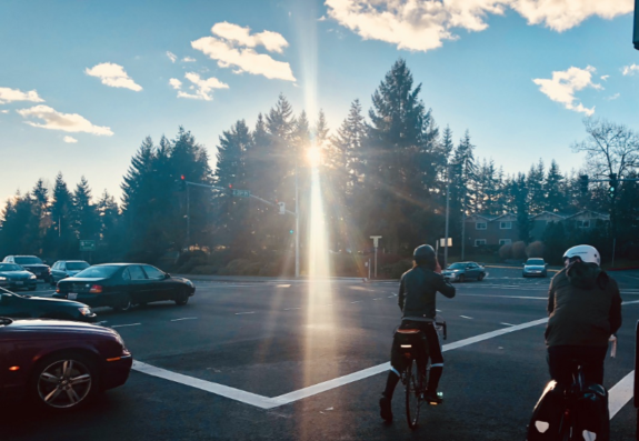
The trail head is kitty-corner from where I’m standing. In this situation I would usually get in the left turning lane and pop onto the sidewalk rather than crossing the street twice and waiting on two lights. However, the way the trail dumps you on the sidewalk, getting into the left turning lane is more work than crossing twice. While this obstacle is minor, waiting on the lights to turn is a pain.
Once I got back on the trail it was a down hill breeze, and I thought, “This is gonna be awesome!”
Discovering Northup
Here is the section of the trail circled in the map above, also known as Northrup. I’m not sure if it’s a neighborhood or a town, but after my ride I think I know Northup better than Redmond. The light blue line is where I diverged from Google. It’s strange because the trail actually continues until the red X. Between the red X and the circle on the left is all street/sidewalk riding, and it’s super confusing.
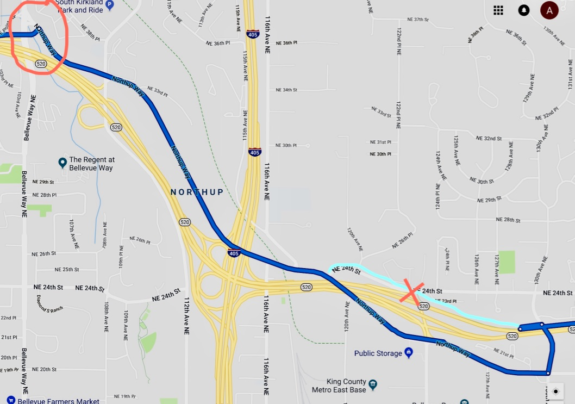
Here I am at the red X above where the trail dumps me onto the sidewalk of NE 24th St in Northrup. There was a 520 Trail sign, so I guess this piece of sidewalk — including the worn patch of grass on the residential yard to my right where people inevitably ride after crossing the street — is the bike trail.
This is the beginning of a mile and a half break in the 520 Trail.
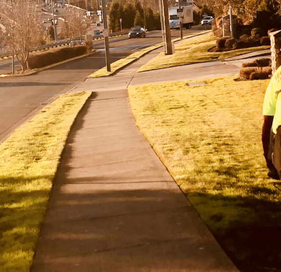
The ride along NE 24th is narrow and steep, but short. Once I get to the bottom of the hill there’s a sharp right turn onto Northup Way, which has a nice, wide and well-signed bike lane for about four blocks. The rest of the ride down Northup Way is a skinny roadside bike lane that felt like it was an old road shoulder line until they painted a bike sign on it. It’s only about six or so blocks until the next signs of life, but the road diverges so far from SR 520 that I began to wonder if I was still on the trail.
While writing this post, I was surprised to learn that this section of the trail is actually part of the latest Northup improvements to the 520 trail completed in November 2017. This is disappointing to me because I’m sure this latest development was praised as progress and complete, but my experience was that it felt like the beginning. I fear that the city of Bellevue will pat themselves on the back and fail make future investments in the 520 Trail.
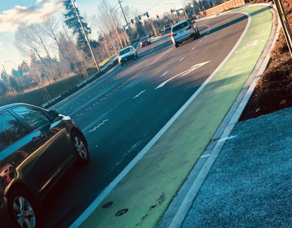
After a little self doubt I finally end up at what seems to be the trailhead next to the freeway entrance. This intersection is massive and I have no idea what that sign is trying to tell me, but I see the freeway so I think, “I’ll figure it out once I get across the street.”
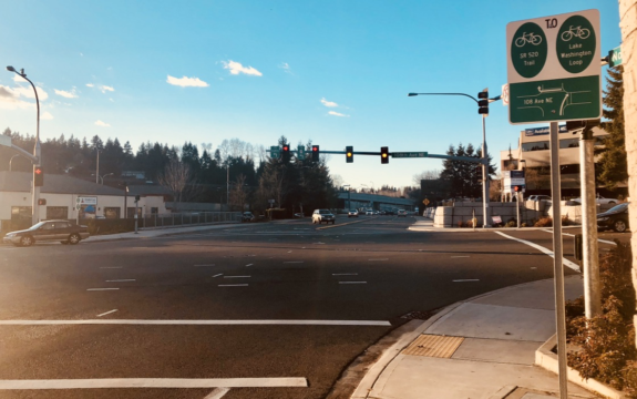
Wrong! I’ve made it across the street, “What did that sign say?”
I see a bike sign and a bike lane near the freeway entrance, so that must be it. Wrong again. I bravely pedaled up that death trap and promptly got lost. After back pedaling to the sea of signs, I noticed a group of experienced riders in the left turning lane on Northup Way and followed them to the trailhead.
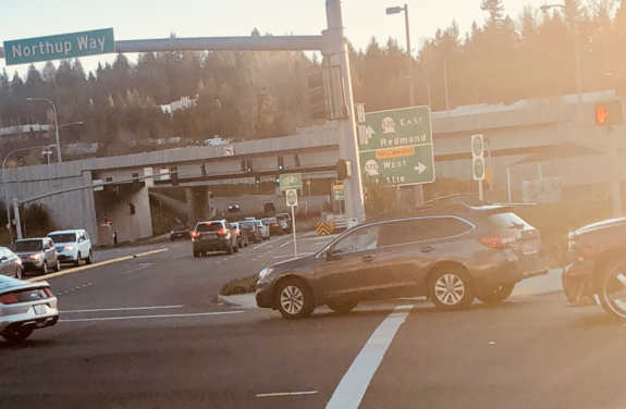
Oh yes, the trail. From here on out it was smooth, protected-bike-trail sailing until I got to Seattle. This segment of the trail is a bit hilly, but doable.
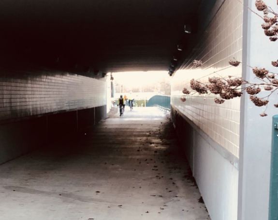
Looking back at my Northup journey, the 520 missing link is much simpler to navigate than the signage and Google Maps might indicate. To sum it up, here’s my way of navigating Northup missing link: Once the proper 520 Trail ends, make a left on NE 24th St, turn right onto Northup Way, then left onto the 520 trailhead just before Bellevue Way NE. Use any sidewalk, bike lane, road shoulder or traffic lane you are comfortable with to get there. That’s it.
The 520 bridge
Finally, I make it to the bridge, and it’s breathtaking. This image doesn’t begin to express the beauty of the view on this picture perfect day. It was fantastic to see all of the smiling faces, their eyes filled with the opportunity that this trail opening means. The opportunity to take in more fresh air on your daily commute, free yourself from traffic, and experience a unique perspective of the Lake Washington that is usually reserved for the class of folks that can afford boats.
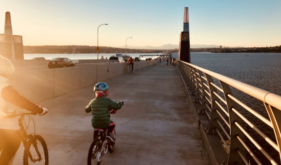
While in awe of the mountains before me and breathing in the fresh crisp air, I quickly noticed the killer cold headwinds. The ride is only around 15 minutes, but the eastbound evening winds are no joke. My toes froze halfway through. Just before I got on the bridge, there was a friendly woman offering toe warmers, but my ego got the best of me, so I pedaled right past her.
Seattle
Home sweet home. Pedaling my way into the city via the 520 Bridge was bit of a surreal experience, like shooting through a wormhole in a science fiction flick. It’s a strange feeling to take a route so often in a vehicle, and then finally experience it on a bike. It’s both familiar and unfamiliar.
Once I arrived at Montlake, I was met by a couple of festive tandem riders looking onto the unmarked residential street in oblivion. Since these are my stomping grounds, I know where to go from here, but it’s definitely not intuitive.
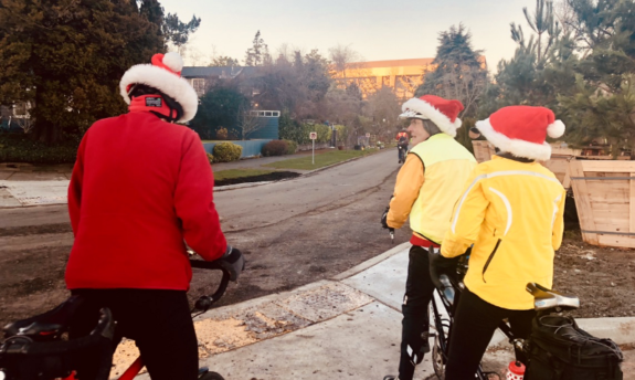
I’ll stop here, but note that navigating to the Burke from the 520 bridge trail is no easy feat. It’s about a half a mile of bumpy residential streets, little signage, and cracked sidewalks.
Not quite there yet
While I’m overjoyed that the 520 Bridge is finally open to bikes, the lack of bike infrastructure on either side of the bridge makes this milestone bitter sweet. So sweet to have the opportunity to cruise across Lake Washington on my two wheeled analog transport. But bitter that getting to the bridge can be downright dangerous for an inexperienced cyclist.
I will continue to celebrate this accomplishment in the Northwest, but I share my story in order highlight that so much more still needs to be done. Hopefully, this story helps you take on this journey and I encourage anyone to share their tips in the comments so that we can all enjoy this majestic ride in the days to come🚴🏽


Comments
28 responses to “Aviva Stephens: Pedaling my way to the 520 Bridge”
Thanks, Aviva! It’s important for city and state DOT staff to hear what it’s like for someone to navigate a route for the first time. If it’s this confusing, then it needs to be fixed. A lot of people would just give up and never want to ride there again.
Agree!
Hitting the 520 trail and riding a Lime-W are my plans for this weekend. Maybe both at the same time.
*Lime-E
Northup Way used to be worse. Until last year, it had no bike lane, no shoulder, not even a sidewalk. Just two traffic lanes, and that was it.
If you didn’t like it, the nearest detour was about a mile out of the way, and still had no bike lane or shoulder, just less car traffic.
I think that’s why Aviva’s experience is so helpful. Those of us who remember the way it was know it is better now. But that’s not a good baseline for comparison. The question isn’t whether it is better now, the question is whether it is good now. If it is still a weak spot in the route that people find uncomfortable, then the work is not yet finished.
I would say it is a weaker spot particularly in the intersections and some of the driveways. Great for Cat6 riders but far from all ages and abilities.
This is a perfect summation of the 520 trail. The Northrup Way leg of this section is fairly horrific, broken up in odd places and forcing you to make a hair-raising left turn in traffic to the trail going west (or wait forever with “begging” crosswalk signals), and the comically misdirecting signage when you’re heading east. A dedicated bike path could have been built along Northrup’s eastern side, but Cars Uber Alles. Once you do get used to it, it’s not so bad, but I still hate Northrup Way, even with its halfway decent bike lane.
For what it’s worth, it’s awesome how the 520 Trail connects with the Sammamish River Trail, making it a super-quick to roll to Woodenville and Marymoor Park. So, for all its faults, I’m super happy the 520 Trail is now mostly in one piece.
Great article!
Can you use the CKC as a Northup Way bypass, now that the railroad tracks are gone? There’s still those two blocks to deal with with a steep hill and no bike lane. But at least there is a sidewalk. And it’s only two blocks.
No it sends you in the wrong direction from the trail.
Was there last weekend, trying out a ride of 520 bridge -> CKC -> Willows/Redmond Connector. At the Southern terminus of CKC, though the tracks are gone, it’s didn’t seem tamped down enough to ride safely yet. And it was a killer grade getting up the 100 feet to the trail level from the 520. I was rather looking forward to the time when I could do the opposite — avoid the crazy grade by going down Northrup way to the “new” Southern terminus of the CKC.
I rode a Lime-E bike to this morning from Seattle to Kirkland and had to go up that very hill to get from the 520 trail to the CKC. Thanks to the motor, the hill climb was pretty easy.
I did the ride in the other direction for the first time, going west to east. Getting onto Northrup was more straightforward in that direction. However the turn onto 24th is unmarked, and we continued on Northrup until the bike lane ended about a block later.
Thank you!!!
I am planning on trying this route out soon, and would have totally gotten lost without seeing this (it sounds like I still might). Hopefully it is still a shorter/faster/easier route than going over to I-90, have been looking forward to trying it.
It’s a shame they could not spare the relatively small expense to build a real bike path when they rebuilt the highway : (
Thank you Aviva for making this post. Having lived right near the trail and ridden this ride even before the bike lanes were added to Northup, I didn’t realize that this would be confusing. The Northup section is much better now, at least there are sidewalks to fall back on. However I still HATE, HATE, HATE riding that section, especially at night and in the rain. Going downhill you move so fast and there are so many driveways with cars exiting that it is very nerve racking. Add the cars whizzing by you at 40+mph and it is not a fun ride. I had to laugh at the comment above stating that it was not all ages or abilities. One thing you didn’t mention which is a problem, at least for me, is the expansion joints on the bridge. They are so high that every time I ride across them, I get a jolt. I think they are designed to be mini speed bumps to slow down bikes.
Alan
The Google routing is strange. The default routing that Aviva followed is longer than taking the trail to 24th. If you plot the trip in the other direction, west to east, the route correctly goes Trail > Northup > NE 24th St > Trail. Maybe some bicycling Googleites will read this post and fix the routing.
The trail junction at the west end of Northup is poor. From the trail you arrive at the sidewalk. Clues that maybe you should stay on the sidewalk are that there is no curb cut and sidewalk is a bit wider than normal. A sharrow or other indication that the sidewalk is the trail would help.
Google fails westbound by not indicating you should cross to the opposite sidewalk at 108th. (In Seattle there is half a chance SDOT would give us a bike box for the left, instead of the infantile double crosswalk maneuver.*) Google wants you to stay on Northup and then turn left to the trail before Lake Washington Blvd, w/o a turn lane and ignoring the fact that there is no curb cut. If it’s going to miss the turn at 108th, it should direct you to cross Lake Washington Blvd onto Points Dr and then turn to the trail.
*Bikes are slow. Building infrastructure that makes them slower just ensures a lot of riders will find a different way even if it means mixing with traffic.
More about the 108th intersection: The route should be indicated with green paint on the road. If I have a green light, the first time through that intersection I’m not going to notice the wee bicycle route sign. There are more important things to watch for when entering an intersection. Also, the sign should be past the stop line. Again, the first time a rider stops for a red light, he or she will probably wait at the stop line and fail to notice the bike route sign.
As a cycling Googler I have some idea why the diversion to Northup is taking place only westbound; zoom in where the 520 Trail intersects NE 24th and notice that NE 24th is modeled as a split roadway, and that the trail doesn’t connect through to the westbound roadway. If you set tight enough endpoints around this intersection it will send you westbound on the eastbound side of the road, but it tells you to walk your bike on the south sidewalk, which is penalized heavily enough that the Northup diversion is preferred if it’s around the same distance.
I’ve reported this through the standard “right click, Report a Data Problem” flow. It probably wouldn’t hurt if a bunch of other people did so. I actually reported this a while ago but probably wasn’t clear enough in my report… if my new report isn’t addressed pretty soon I’ll escalate it with links to this article about how bad we’re looking.
The thing at Northup/108th is a bit different — we don’t have many details of the layout of bike paths and lanes there, we essentially just know there’s some kind of separated path west of 108th and on-street bike lanes east of it. We (i.e. some computers in a datacenter somewhere) assume that it’s straightforward to continue from one to the other; in this case it’s not straightforward Because America.
Thanks for the reply and explanation. Google’s routing facility is truly a wonderful resource and it’s FREE! That said, error reports don’t seem to get much attention. I just checked a spot I’ve reported several times; it’s still wrong. Google directs an illegal and physically impossible turn, for cars as well as bikes. (It’s at the Arboretum. Route from Foster Island Rd to Calhoun St. The left onto 26th is blocked by a center median.)
Thanks for the write-up! I’m glad to hear I’m not the only one who is confused by the routing on Northup, but now that I know where I’m going it won’t be so bad.
I did SeattleRedmond for the first time last Friday, International Winter Bike to Work Day, and was misdirected a few times on my morning eastbound journey, then completely lost even with stopping and pulling up Google Maps westbound that added another 30 minutes to my time. I pretty much agree with every critique that Aviva notes in her article about the trail signs being useless and my surprise at how bad the Northrup segment is.
I still plan to commute by bike regularly, especially when the weather dries out more consistently, but the first thing I did when I got home that day was order a phone mount so I could have the map open and not miss crucial turns that lead to downhill segments making it prohibitively difficult to track back.
I commute Kirk to Sea. While the 520path saves me three miles over I-90, the trip from Montlake to the ferry terminal area is massively confusing. Do I go through the arboretum? take Lynn to Delmar (then what?)? go over Cap Hill some direction unbeknownst to me? maybe take the train downtown? If you can tell, I’m as confused about the Seattle side as you are about the Eastside.
I do enjoy the trip over the water…
If you want to avoid climbing Cap Hill, an alternative is to go North over the Montlake bridge and get on the B-G. You can go south again over the University Bridge and take Eastlake, Fairview, Valley, 9th, Bell, 2nd. Variation, avoid Eastlake by getting on the Chesiahud route on Fairview by Lake Union. Or a mile longer but more bikepath, B-G to Fremont Bridge, Westlake cycle path, 9th, Bell, 2nd. Variation take, Dexter rather than Westlake.
There are lots of options depending on your time constraints and tolerance for city traffic. The default route Google plots from the trail in Montlake to the ferry terminal, using Broadway on Capitol Hill, is not real fun but I don’t think it has any great hazards. Although only 5 miles there is some stiff climbing and lots of traffic lights so it might be rather slow.
A flat option, 90% on trails, is to get on the Burke, cross the Fremont Bridge, get on the Ship Canal Trail, then south on Gilman/20th (which has a PBL now), to the Interbay & Elliot Bay Trail, with a final mile on Alaskan. This is 10 miles and would be my choice for a safe, low-hassle route. Detail: When the Ship Canal trail branches at Emerson, stay on the south side. That will put you on the PBL at the west end of Emerson, connecting to the PBL on Gilman.
I remember one BallardRedhook ride deciding to attempt doing the 520 stretch to make it a loop (when you still had to use the bus as portage). My buddy and I are pretty seasoned, adventurous riders and the Northup stretch definitely threw us a curve ball, as we hadn’t prepared for it; we assumed the 520 trail was a trail the entire stretch (up to the new bridge at the time).
We decided to just go by the seat of our pants, but we made it. This was on a Saturday morning, so traffic was pretty light. I can’t imagine trying to wayfind this route during rush hour, even with the newer improvements.
Thanks to Aviva and everyone who responded to her post about the SR 520 pedestrian-bicycle trail. We appreciate the feedback, especially about the Northup Way improvements and wayfinding issues in Bellevue.
A couple of points about the Northup project, completed late last year. This work was mostly funded by the state Department of Transportation and intended as an interim connection to the SR 520 trail. A permanent, off-street trail is tied to plans for the Interstate 405/SR 520 interchange and is likely many years in the future. The Northup improvements provide a more immediate link.
Also, the project design tried to balance the needs of bicyclists, pedestrians and drivers, a challenge for sure given the limited width of city right of way, vehicle traffic volumes and the many businesses (and driveways) along the roadway. It added sidewalks and bike lanes, which were not there before.
Regarding signage and directions at transition points such as 108th Avenue Northeast, Northeast 24th Street and 148th Avenue Northeast at Northeast 29th Place, there were some good comments. Our planning and engineering staff will be looking at ways to improve wayfinding, including the use of green pavement markings, one of the suggestions.
One improvement is on the way. Work will begin this spring to add buffers to the existing bike lanes on Northeast 24th Street, from Northup Way east to the SR 520 Trail, funded by the 2016 Neighborhood Safety, Connectivity and Congestion levy.
If you have other thoughts or suggestions, feel free to email them to me directly and I will make sure they get to the appropriate Transportation Department staff. Thanks again for the comments. — David Grant, public information officer, City of Bellevue Transportation Department, [email protected]
Does the 520 trail connect with any of the newer 520 fwy bus stops? For example, in my commute to Bothell, I might wanna ride across the 520 bridge and later ride the Sammamish trail from Redmond to Bothell, but in between, I might not have the time (or patience) to navigate between the bridge and Redmond. I could just throw my bike on a Redmond-bound bus, IF the bike trail intersects with one of the 520 bus stops. Does it?
Jill, there is a bus stop at Hunts Point just after the bridge and you can throw your bike on there. You may need to take and elevator or stairs with your bike though. I know the 545 bus takes you into Redmond where you can hop back on the 520 trail and onto the Sammamish trail. I’ve never done the ride to Bothell so not sure how solid the trail is along the way. But you can avoid the Northup traffic at least.