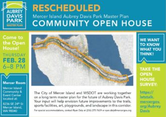
 The Mercer Island Parks Department is creating a master plan for Aubrey Davis Park, including the Mountains to Sound Trail, and they are looking for public feedback.
Their open house got snowed out, so the rescheduled event is 6–8 p.m. tomorrow (Thursday) at the Mercer Island Community and Event Center (map) in Luther Burbank Park. You can also comment via their online open house through March 8. But be prepared, it’s pretty long.
The online open house shows a handful of potential trail design options depending on the location, and all of them would be 12 to 14 feet in width plus some gravel buffer:
 Today, the trail is mostly lovely except for the stretch along the town center, where it crosses in front of driveways with poor visibility and crosses streets in crosswalks that could use improvement. Signals that separate trail and turn phases could be a good addition, as would better walk signal timing and bike detection. Elements of protected intersections could also work well here to make biking and walking more comfortable. The stretch of trail that passes through the transit center bus stops is also a bit awkward and could use more separation from the walking and waiting spaces.
More details on the open houses, from Mercer Island Parks:
The City’s Parks and Recreation Department is leading a master planning process in partnership with the Washington State Department of Transportation (WSDOT) to establish a shared community vision for the future of Aubrey Davis Park.
The in-person Open House is scheduled for Thursday, February 28, from 6:00-8:00pm at the Mercer Island Community and Event Center.
An online Open House will be taking place from Thursday, February 7 to March 8. Join us from the comfort of your home to take an interactive survey, learn more about opportunities for this park and give us your feedback.
We look forward to seeing you in-person on February 28!
Questions? Call 206-275-7609


Comments
3 responses to “Learn about the future of Mercer Island’s Mountains to Sound Trail at Thursday open house”
I used to avoid the trail after it crossed the East Channel bridge until I got to the West Channel I-90 bridge. The side street, (North Mercer Way) is low traffic and just gorgeous. Yes having better sight lines on the official trail is a good idea, but if I was commuting that way again, I doubt I would be riding it.
The online survey was disappointing. It’s mostly about planning for recreation amenities. It never identifies bicycle commuting as a trail use. I called out an area near the bus stop that dangerously mixed bicyclists and pedestrians. I also called out another area that has terrible lighting for night time bicycle commuters. When I commuted across Mercer Island, I took the streets like Gary. I think most commuters do.
They painted separate bike/pedestrian lanes for that little stretch of i90 that goes through the transit station and it highlights the issue of Parks & Recreation designing things without actual traffic experience. First of all, having one lane shared for BOTH DIRECTIONS is completely idiotic. Secondly, pedestrians never actually pay attention to the paint in the first place unless it’s physically separated. It would be better for everyone if they didn’t try to overthink this and simply put up more signs that said STAY ON THE RIGHT-SIDE.