This is part of our ongoing How To Bike In Seattle series, a collection of posts to help folks get rolling around this beautiful place.
OK, so you’ve decided you want to start biking around Seattle for transportation. But how do you find a good route to ride?
By far the best way to find a great route is to ride with a friend who knows the area. So for all you who are already familiar with biking in town, offer this to your friends. Leave early, communicate clearly and ride at whatever speed the new rider feels comfortable. Riding with someone makes the whole experience of getting started much less intimidating. Many people just need to ride a route one time before they feel reasonably comfortable riding it on their own.
If you don’t have a friend to ride with, the fastest and easiest way to get started is to plug your destination into Google or Apple Maps, select bike directions and follow those. These services rarely pick the best routes, but they usually spit out usable options. If they lead you to a street that looks too busy (for example, they both tend to suggest busy sections of Rainier Ave S), stop and re-map from your new location to see if they suggest an alternative.
If you want to do a little more research into routes before you get started, there are a handful of helpful tools to get you started. You can find an updated list of area bike maps on our Seattle Area Bike Maps page.
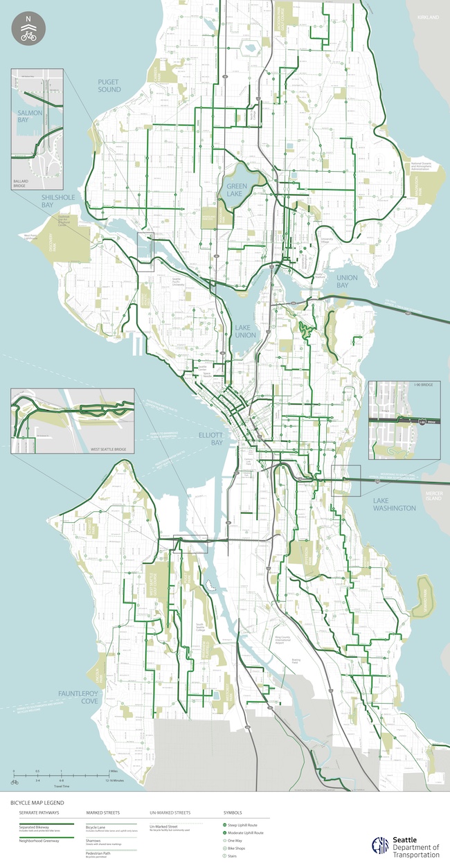
Let’s start with the official 2022 Seattle Bike Map (PDF):
 The official bike map is best used for identifying high-quality facilities, like trails, protected bike lanes and neighborhood greenways. Its biggest shortcoming, however, is that because the Parks Department generally resists having official bike routes within park boundaries (a very questionable policy, but that’s another story), the official city map will almost never route your through a park unless the park has a road or regional trail through it (like the Elliott Bay Trail through Myrtle Edwards Park). Many of my favorite bike routes travel through parks because parks are awesome. So the city’s bike map is a useful tool, but you’re going to have to find your own park-loving routes.

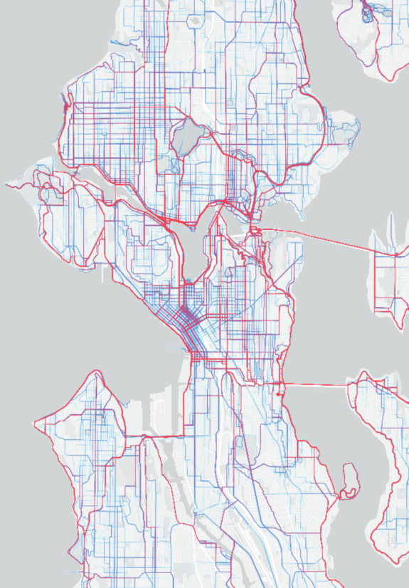
The Strava Heatmap is another useful tool for finding the bike routes commonly used by Strava users who share their GPS data with the service. Just be aware that some of the highlighted routes are popular recreational and training routes since Strava is used heavily for that purpose. So just because a route has a lot of use doesn’t mean it has great (or any) bike infrastructure. However, most the heavy use routes are good options for getting around town on a bike.
You can also check Ride With GPS for some bike routing advice either from their automated bike route finder or by searching to see if someone has posted a route for where you are going. You’ll need a free account to unlock many of the features and paid account to unlock them all.
If all else fails, you can always flag down someone biking by and ask for directions. In general, people love sharing their bike route knowledge. Some may even say, “Follow me.”
If you’re like me, you’ll never stop making small adjustments to your bike routes. Sometimes I ride different routes just to mix things up and explore new blocks of the city. Other times I go out without a map to try to navigate using only street signs and my memory of the city. But I write a bike blog, so I may be more of a bike route geek than most.
Learning to navigate the city by bike will make you intimately familiar with the city in a way that only a bike can teach you. A bike ride is a love letter to your city. Seattle is a bike city in progress, and there is no complete network of high quality bike routes you can follow. There will be gaps where you have to improvise and find your own way. But even the failed routes where you end up biking on the sidewalk of an industrial street or walking up a steep hill teach you something. You can plan all you want, but ultimately you just gotta go for it and see where your bike and your city take you.


Comments
3 responses to “How To Bike In Seattle: Finding a good route”
Great tips, Tom! When I was first trying out routes, I usually would use a combination of the official map, Strava heatmap, and verifying what parts of the route look like on Google Maps street view. Now that I am pretty familiar with the area routes, I’m pretty much on autopilot.
I have started a site with my favorite way to get to various places here: https://seattlebikeroutes.wordpress.com/a-to-b-routes/
I try to keep it up to date with detours/route improvements.
These are great, thanks for sharing!
Another great source for routes, especially recreational ones, is searching through the Free Group Rides (FGR) at Cascade Bike Club. The best (and possibly most fun) way to learn the route is to participate in the ride, but it’s also just a great source of ride maps.
Start at the main page — https://cascade.org/rides-and-events/free-group-rides — then click on View Ride Calendar. Once you find a ride that looks interesting, look at the description and comments. There will almost always be a Ride With GPS link to the map and cue sheet, usually at the bottom of the description or as one of the first comments.
Thanks, Tom & @Nick vdH! These are great resources for the uninitiated and also a great intro to the value of the Seattle Bike Blog. I’ve been riding in and around Seattle for many years and am pretty familiar with routes in neighborhoods I frequent, but things are changing/progressing quickly so I still find the resources you linked to useful. Mainly though, especially with the increasing popularity of e-bikes opening up cycling as an option to a whole new audience, I’m eager to get these newbies up to speed and oriented for their and all of our sakes.
I’ll send a link to this article to folks I think will benefit.