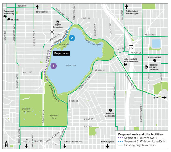
SDOT released the 90% design plans for the Green Lake Outer Loop, and they show that the bikeway is still on track to finally complete a biking and walking route 112 years in the making.
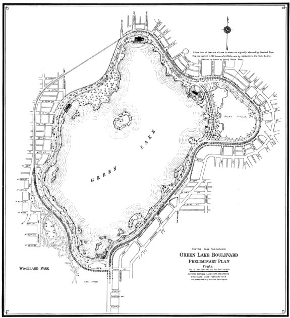
The advanced design document shows a bikeway very much like the one SDOT showed the community back in a February open house. The city’s plan is to repurpose an abandoned transit-only lane on Aurora to build a two-way biking and walking path along the west side of Green Lake Park. (CLARIFICATION: As pointed out in the comments, this section was not a transit lane, but the sections immediately before and after are. Because of this, the lane serves little to no car traffic purpose because anyone who merges into it will just need to merge back a few blocks later.) This section was originally supposed to be part of the city’s park boulevard system, but the construction of SR-99 took over the space after cutting through Woodland Park. This project will not completely heal the wound created by the park-splitting highway project, but it will at least give people a space to walk and bike.
The project got an extra kick in the pants in the spring when the Parks Department inexplicably banned bikes from the Green Lake Path even though there was no alternative along the west side of the lake. The lake path was never a great transportation option because it can get so busy and was technically one-way for wheels, but since March people have been forced to either break the rules or find some kind of detour on their own. Riding around the lake is an obviously desirable route. Once this bikeway is complete, people won’t be able to imagine our city without it.
Below is a look at the 90% design plans (PDF):
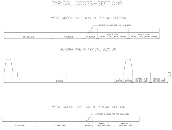
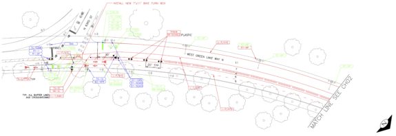
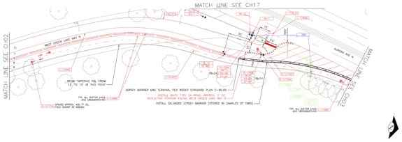
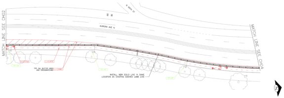
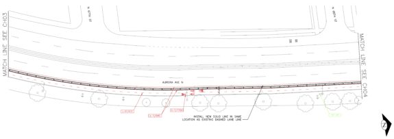
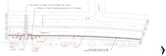
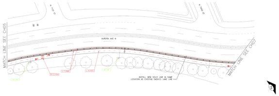
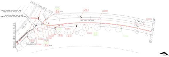
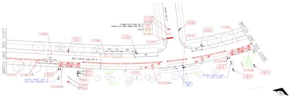


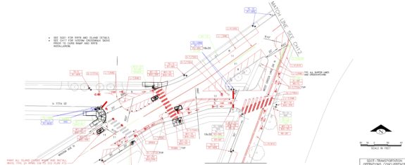
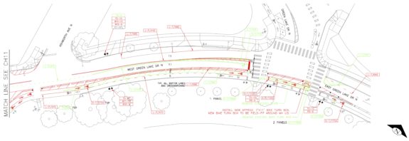
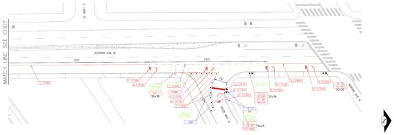 North of the bikeway, the lane becomes a right turn lane like it is currently. So there will likely be no impact to car traffic on Aurora. The biggest change for people driving is that they will no longer be able to turn right from Aurora to West Green Lake Drive N.
Construction is still scheduled to begin in “summer/fall 2022,” according to the project webpage. It’s getting a little late into summer, but hopefully it still breaks ground this year.


Comments
8 responses to “Nearly-final plans show Green Lake Outer Loop bikeway is still on track”
I much appreciate the plans for curb bulbs at 77th and Winona. I hope they consider reducing wait times for peds and cyclists at the 67th, 77th, and 92nd intersections with Aurora.
Are people comfortable with taking the abandoned transit lane on Aurora ? While the buses currently get off Aurora and use Winona, that adds considerable time to what is a Rapid Ride line. I can imagine that, at some point, the E line will be rerouted to stay on Aurora.
I suppose, using the transit lane for bikes right now makes sense. If Metro wants to repurpose it for transit in the future, the bike lane can always be built next to it at that time.
I actually think the Linden detour is one of the rare times it does make sense for a transit route to deviate from a straight line. It doesn’t add that much time, and improves the walk-shed of the route, in particular eliminating a crossing of Aurora for anyone who isn’t going to the park.
As you can see in the Olmsted map, Linden was the original highway route, which is why it is developed the way it is (and so wide).
You write: “an abandoned transit-only lane on Aurora”. There was never such a transit lane. The bus routes have always used Linden Avenue North northbound to provide coverage; there has been no sidewalk on the northbound side, so there could be no bus stops. Between 1940 and 1963, electric trolleybus Route 6 served Linden in both directions. Diesel routes 6 and 359 served Linden in both directions; Route 360 was a one-way peak-only service that did not stop; Route 358 replaced them in 1999. The E Line replaced Route 358; it uses Aurora Avenue North southbound and Linden northbound. In transit network design, there is a tradeoff between speed and access; both are important.
I should have written that more clearly. I mean that the lane is a transit-only lane before and after this stretch, so the lane is “abandoned” in that it’s not serving a traffic use because anyone who merges into it will just need to merge back out a few blocks later when the transit lane returns. Maybe “abandoned” is the wrong word. Isolated? Rendered useless? I’ll clarify the point in the story.
The northbound BAT lanes ends at the Whitman Place North off ramp to North 63rd Street. A northbound peak period BAT lane reappears at Keen Place North. Perhaps a transit flow improvement will be off-peak BAT lanes as are used in Shoreline. The business district south of North 80th Street dates to the 1930s.
Thank goodness. I was worried the north end might have to go more than 3 months without any new protected bike lanes being built.