Construction on the first segment of the Beacon Hill bike lane (now called the Beacon Ave S & 15th Ave S Safety Project) is still scheduled to begin a year from now, and the project team has advanced design to the major 30% design milestone. This is the point where major designs elements are established, though there is still room for smaller adjustments before it is final.
The design is moving forward with one-way bike lanes on each side of 15th Avenue S and Beacon Avenue S from the Jose Rizal Bridge to S Spokane Street. The bike lanes will also be protected using a concrete curb. The bike lanes will be as skinny as 4.5 feet plus space for the barrier in the most constrained sections of 15th Ave S, which is an issue we explored in depth in a previous post. Each general traffic lane will be 10 feet wide in these constrained sections, so this isn’t a matter of designers short-changing the bike lane. It’s just a constraint.
This constrained street width is also why there is no space for on-street parking on 15th Ave S, a significant point of contention. In response, SDOT has been scouring the area to find ways to increase parking availability on nearby streets. They are even going as far as deleting part of a skinny paint-only bike lane on 14th Ave S between S Grand St and S Plum St to add parking there. The added parking will reduce the roadway width, which slows traffic speeds, and SDOT will also add some speed humps to further reduce speeds and make the mixed traffic lanes safer for those biking there or heading to the nearby elementary school.
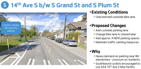
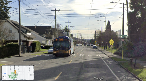
While 99% of the time Seattle Bike Blog would be extremely against removing an existing bike lane, this lane is not particularly useful. It only exists in this two-block, park-adjacent section beginning at Grand and ending at Plum, and doesn’t make any major network connections. I suspect this bike lane was added primarily for traffic calming purposes rather than bike network purposes. It even has a bus stop in the middle of it. So in the context of this project, which is adding protected bike lanes a block away, it could be a worthy compromise. I don’t love it, though.
Updated design
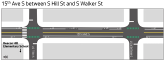
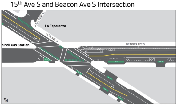
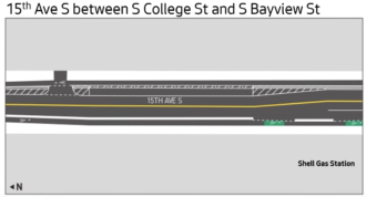
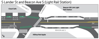
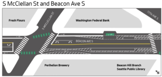
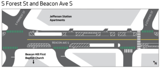
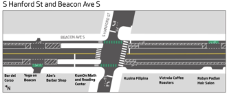
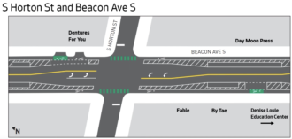
You can look through the full engineering design plot in this PDF, but it can be a bit difficult to parse. But SDOT staff presented some simplified graphics during their recent public outreach meetings for the project:
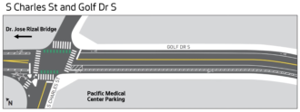
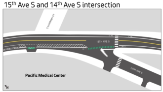
You can watch the full SDOT presentation here:


Comments
8 responses to “Beacon Hill bike lane plan gets more detailed + City finds ways to add nearby parking”
I’m really happy about the 15th ave S and 14th ave S intersection. Biking uphill, already tired, it’s easy to get pretty scared if you’re going slow and cars are merging through the bike lane.
I hope that’s a concrete teardrop shaped island and concrete barriers.
Good research and reporting Tom. Another way around this calamity of roads is to extend the Mountain to Sound along the eastside of I-5 past Holgate. Extending to Beacon Ave. then dropping down to Airport Way at S Forrest St. connecting the SODO trail and west toward West Seattle and Alki. There is a graded path existing past Holgate as far as S Lander St. Less climbing and more connections. This is the best way to clean up the East Duwamish Greenbelt as well.
Thanks for this reporting. Especially for sharing the designs.
I’m not so much worried about the bike lane disappearing 14th Ave S as about adding parking on College street. College street is the first east-west connection after the I-90 trail (not counting stairs). I often use this to climb up from the open street on 18th. Which is a steep climb meaning you go slow. Currently, there is enough space for cars to pass you. Which will be taken up by the new parking.
I am also worried about this. It’s only 25 feet wide and 10% grade where they propose to add parking. It’s my partner’s preferred route to/from the school because it’s more direct and faster than going the long way around via the Mountains to Sound. Of course by the time they finish construction probaly kiddo won’t even be going to the school anymore. 😭
The main issue with removing that useless paint bike lane and putting in parking is it will make already bad behavior by people dropping off by car worse. The very first day of kindergarten we biked to school: up mountains to sound trail and then up 14th (less steep than 12th, not as terrifying as 15th). When we got to 14th near the school we almost got hit several times. We’ve since chosen to take 12th and go behind on 13th for drop off as much as possible. It is much more narrow and always has cars lining both sides where legal so folks are required to pull off and take turns. Awkward on a bike but doable and everyone is going slow. On 14th we quickly learned some folks dropping off in cars will pull over erratically in any spot that seems free — or even doing sudden U-turns. This doesn’t happen in the paint bike lane section much today but as soon as it’s legal parking I expect it will. It’s so bad that when I was doing crossing guard duty at Plum for a while, the principal had me put out cones to make the clear zones adjacent to the crosswalk more visible (still some folks would do wild turns and narrowly miss a cone).
One might say that once the 15th bike lane is in biking families would use it and then just go over to 14th at the school. But the short block is very steep and not very bikeable (even in an ebike it’s work). Now I admit the bike lane there is useless but I don’t think replacing it with parking will make things safer for parents taking kiddos to school by bike. :/
Thanks for this. Really helpful to have observations from someone who has done crosswalk duty here. Perhaps the project team and school can create a more intentional and safer school drop off plan for these blocks. Sounds like that is needed regardless of this bike lane change.
This seems to be a common problem around most schools in Seattle. Many a would-be bike commute instead becomes another car drop off because any safe streets infrastructure that exists is invalidated by the dangerous behavior of parents behind the wheel in the blocks immediately around the school. (In my day we rode the bus…)
The most dangerous part of my commute by far is passing Mercer Middle School during drop off at the wrong time of morning. The parents come whipping out of the parking lot in their oversize SUVs never bothering even a glance up and down the sidewalk where their kid’s friends are walking, better yet the clearly marked bike lane they have to cross. They DGAF
Spot on Rachel. SDOT should be in the business of not allowing bad behavior by design instead of designing to allow bad behavior. All citizen groups should adopt this: designing to not allow bad behavior.