— Advertisement —
  • After community urging, SDOT adds last-minute safety improvements to 15th Ave NW paving project

    Concept image showing the planned NW 51st Street crossing of 15th Avenue NW with two northbound lanes, a median, two southbound lanes and a southbound bus lane.
    From the SDOT project webpage.

    SDOT just added some significant safety improvements to the 15th Ave NW paving project before declaring the design 100% complete and ready for construction. No, the changes to not fix the horrible sidewalks across the Ballard Bridge, which is easily the biggest problem with this stretch of the street.

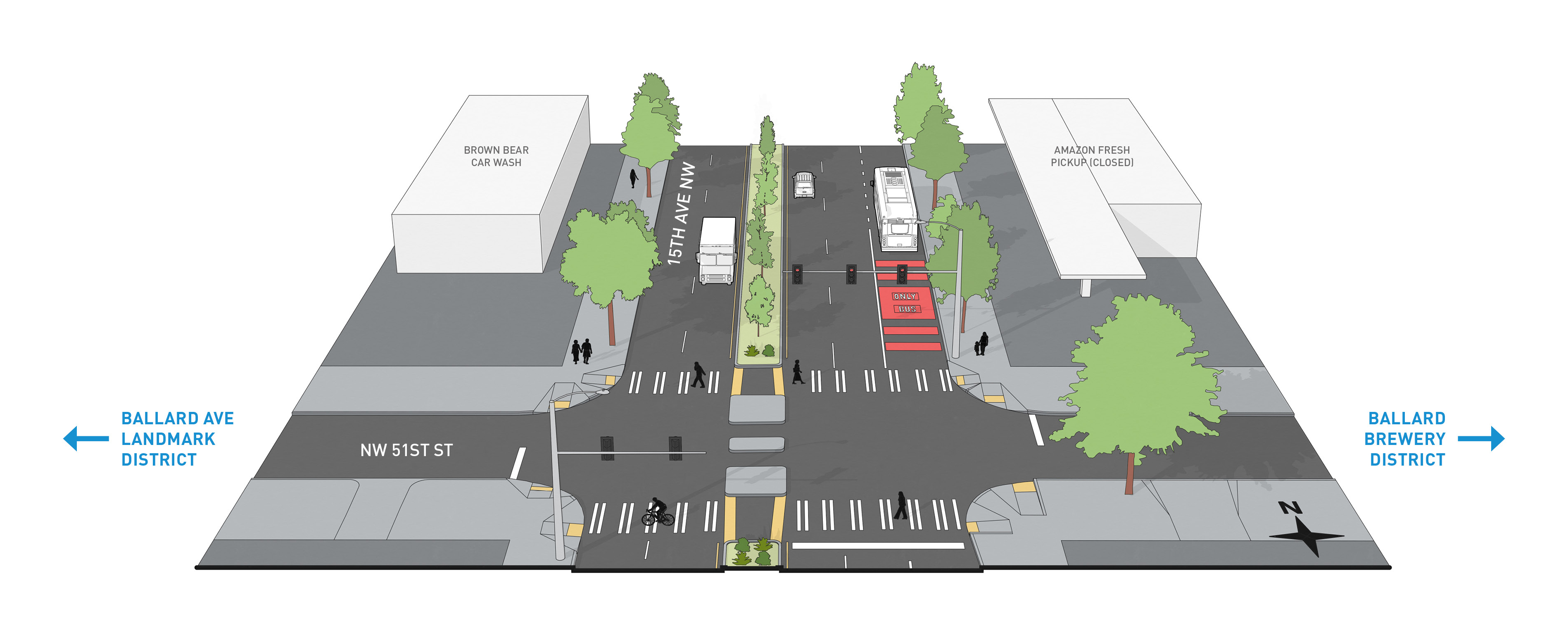
    However, SDOT will add a median between NW 50th and 54th Streets as well as a new signalized crosswalk at NW 51st Street, breaking up a five-block stretch that currently has no safe crossings. The new median will replace one of the three existing southbound lanes, and a new northbound bus lane will replace one of the three existing northbound lanes.

    The result of these changes will be a major calming of this faux-highway cutting through Ballard. They will also mirror the road layout of the Ballard Bridge, which has two general purpose lanes in each direction. There’s no good reason to widen the street to 6 general-purpose lanes following the 4-lane bridge, and we know that having too many lanes encourages speeding and makes streets more deadly.

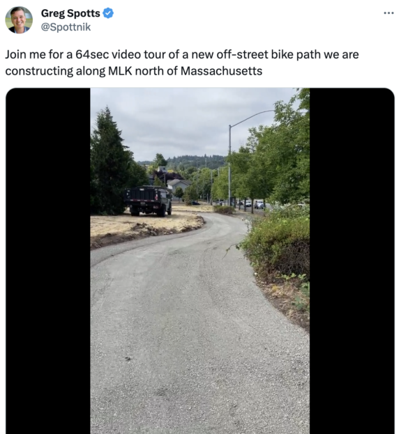
    The changes come after safe streets advocates worked hard to push back on the lack of planned safety improvements to this major paving project. Fremont-Ballard Greenways even put together a detailed plan filled with safety ideas called “Reconnect Ballard.” The group suggested a new signal at 51st and improvements to the signal at 53rd, both of which are now in the plan. Shortly after he was picked to lead SDOT, Director Greg Spotts went on a tour of the area “exploring the potential for safety-related additions to the paving project that is planned.” This project was mostly through design before he came on board, so these changes are perhaps a glimpse into the kinds of changes he is pushing the department to deliver instead.

    The project is planned for construction from “winter 2023 – winter 2024,” according to the project website. More details about the latest changes:

    (more…)
    — Advertisement —
  • Eastlake group is trying to kill RapidRide J (which includes bike lanes)

    I’m traveling home today after a week in St. Louis and Las Vegas visiting family, but I wanted to put out this notice since it is a top priority bike network improvement.

    The Eastlake Community Council is hosting a meeting at 6 p.m. tonight (July 25) at the Agora Conference Center (1551 Eastlake Ave E) with Councilmember Sara Nelson in which they will discuss the RapidRide J project. The Board itself seems divided on it, but there are folks trying to gather support for an effort to kill the fully-designed and ready project.

    This has already been debated to death over a period of many years, and it is very late in the process to try to stop it. But until crews are out there pouring concrete, it’s best not to assume it will definitely happen.

    So for anyone who missed it the first time (or times) this was debated, Seattle studied all of the potential bike routes in Eastlake extensively last time folks organized pushback against the project, specifically the planned protected bike lanes. SDOT’s report on the matter is lengthy and exhaustive, concluding that Eastlake Ave bike lanes are the only viable option for a safe and direct bike route through the neighborhood that serves people of all ages and abilities. There is really nothing left to say about it that has not already been said during the previous years of outreach.

    The project also has significant Federal funding and has gone through the necessary Federal scrutiny in addition to the usual Seattle Process. It is on its fourth mayor, and even bike-lane-killing Jenny Durkan supported it.

    The street is not safe for walking and biking as it is today. The city’s study found that while bicyclists and pedestrians only make up 6.3% of all crashes on Eastlake Ave, they represent a much larger percentage of serious (47.4%) and fatal (39.7%) crashes.

    The street is also in terrible condition. This project will improve conditions and safety for all road users, including people in cars. It will also improve non-driving access to the many great businesses along the street.

    Folks concerned about parking reductions could press the city to scour the neighborhood for blocks where parking could be added. I know of quite a few with parking allowed on only one side even though they are as wide as streets with parking on both sides. They could also expand short-term parking limits on blocks near businesses. These are reasonable asks, and I’m sure you’d find wide support for them. I’d support those effort, for what that’s worth. But trying to kill a needed safety and transit project that’s ready to build? That’s not being reasonable.

    — Advertisement —
  • Cascade, Appellants issue dueling press statements as Missing Link continues to be tied in legal knots

    A group of people with bikes in a mock crosswalk as seen from the driver's seat of a large truck.
    Ballard Oil parked a truck near a planned trail crossing so people could see what it would look like from a driver’s perspective as part of the trail design process in 2017. After a long collaborative design process that included representatives from appellant businesses, a group decided to sue anyway.

    Josh Brower, attorney for the appellant group fighting the Ballard Missing Link of the Burke-Gilman Trail in court, put out a lengthy press release claiming victory (see full statement below). Cascade responded, likening the statement to “a baseball team quitting before the 9th inning.”

    My main squabble with the Cascade statement is that we are far beyond the 9th inning. It’s more like the 90th inning, and all the fans are asleep because the game should have ended a very long time ago. Or perhaps it is the 9th inning, but the officials have spent an entire decade stuck conducting a video review. And also 80% of people are rooting for the Shilshole team. And also it’s not baseball but some other game that nobody enjoys watching.

    The legal fighting is about technicalities, not about the safety of the design or anything else that regular people actually care about. The location and the design of the trail was decided many years ago following an enormous amount of public input, which was clearly in favor of building it on Shilshole Avenue NW because it had the most direct route and the fewest driveways and crossings. All the city needs is the final construction permit before work can begin. But Brower has successfully stalled progress using legal maneuvers, challenging it on any grounds possible and finding ways to keep delaying that permit.

    The latest July decisions in Superior Court are fallout from the Shoreline Hearings Board decision we reported about previously. But now the City of Seattle and Cascade are in the process of appealing over the legal standing of the Appellant group, so more arguing over technicalities that have nothing to do with building a safe trail so people stop getting injured just for trying to bike through Ballard.

    Pie chart showing public preferences for different Missing Link route options. Shilshole has 80% and Leary has 5%.
    Summary of survey respondents’ route preferences from the Environmental Impact Statement for the Missing Link.
    (more…)
    — Advertisement —
  • Roundup of 2023 primary endorsements from transportation advocacy orgs – UPDATED

    An adult and a kid putting a ballot in a ballot box with bikes in the foreground.

    Your ballot for the August 1 primary election should have arrived in the mail, or should arrive very soon. Eligible voters have until July 24 to register or update your address online. After that date, voters will need to register in person at a voting center.

    Every Seattle City Council district seat is up for election this year, and the new Council will be tasked with sending voters a transportation funding measure in 2024. This is a very important election for steering the next decade of transportation policy and investment, so don’t snooze on it.

    Want to know which candidates will (hopefully) be good for safe streets, bicycling and transit? Below is a roundup of endorsements from Washington Bikes (WB), Transportation for Washington (T4W), the Transit Riders Union (TRU), and The Urbanist (URB). Washington Bikes also published a Seattle City Council “candidate scorecard” based on responses to their candidate questionnaire if you want to get a quick idea of how candidates in your district stand on issues like bike lanes on arterial streets. The Urbanist also published candidate questionnaires they received. I will also include video of transportation-focused candidate forums if you want to hear candidates speak to these issues themselves.

    UPDATE: An earlier version of this post left out WA Bikes endorsements beyond Seattle. I have added them below. I apologize for missing them.

    (more…)
    — Advertisement —
  • Riding STP for a cause

    Why do people ride Cascade Bicycle Club’s annual Seattle to Portland? There are going to be quite a few people asking themselves this exact question this weekend at some point during their 200-mile ride.

    But every year, there are people riding for a specific cause, using the feat as a way to draw attention to an issue or raise funds. Of course the ride itself supports the bicycling and safe streets advocacy and education work by Cascade and Washington Bikes. But many people ride for causes unrelated, or only partially related, to bicycling.

    Below are some of the causes people are riding for this year. Email a [email protected] to have yours added (include a short short description and any relevant links).

    Ride for the Philippines

    Promo image for the Ride for the Philippines. "On July 15th, Board Vice President Rogelio "Kuya Roger" Rigor and Volunteer Marketing Director Ronald Antonio will bike from Seattle to Portland to promote our Foundation's Helth Pillar and raise awareness and material support for communities in the Philippines who are most impacted by natural disasters.

    From the Ride for the Philippines GoFundMe:

    (more…)
    — Advertisement —
  • After 6 years of red tape, SDOT is linking the Rainier Valley Greenway to the I-90 Trail

    Click for video of the in-progress trail work from SDOT Director Greg Spotts.

    The Rainier Valley Neighborhood Greenway opened in 2017 with a key piece missing: A connection the final block or so to the I-90 Trail in Sam Smith Park.

    “One of the coolest ideas in the plan is the new connection to the I-90 Trail,” I wrote in a September 2015 post about the greenway plan. “This was one of the more difficult puzzles in the whole route. All the other connections from the trail to the planned greenway route have ridiculously steep hills.” But when the route opened, it dead ended at the park with no clear way to get to the trail without hopping a curb and biking up a grassy hill. It has been that way ever since.

    The problem was not Seattle, it was WSDOT. Sam Smith Park is a freeway lid that WSDOT built above I-90 as part of that freeway project. Even though SDOT was paying for and building the trail link, which would improve the connectivity of the state’s trail, WSDOT wanted to charge SDOT perpetual annual rent of $24,000 per year, increasing with inflation. But as Ryan Packer reported in November, the city and state had finally found a way forward.

    Once the connection is in place, the Rainer Valley Neighborhood Greenway will be much more useful. The winding and hilly route travels along side streets near Rainier Avenue S as best as is possible. Though it was intended to act as something of an alternative to taking Rainier Ave, it is not comparable. The greenway is far hillier and longer than Rainier, which cuts a relatively flat diagonal across the valley’s street grid. There are many destinations along Rainier that the greenway does not serve. As a Rainier Ave alternative, it fails.

    However, if you think about it as its own thing, a meandering and comfortable route through the neighborhood’s side streets, it’s mostly great (aside from one extremely steep block of 38th Ave S in Columbia City that should not be part of a supposedly all ages and abilities route). Neighborhood greenways are best when they are creating their own paths rather than when they are used as an alternative to installing bike lanes on a street that needs them. They have the ability to connect homes, parks, schools and more in a different way than we are used to. In infrastructure terms, a neighborhood greenway is really just a coordinated series of street crossing improvements, traffic calming and signage. But in a city with streets as confusing and hilly as Seattle, it’s especially useful to have a bread crumb trail to follow because if you make one wrong turn you might end up having to scale a very steep block.

    If you’ve never ridden this route I highly recommend it, especially once the I-90 Trail connection is in place. You can take it all the way from I-90 to Rainier Beach, passing many neighborhood parks along the way. One popular alternative to the steep Columbia City section is to take Letitia Ave S and 35th Ave S between S Charlestown St and S Ferdinand St. Letitia is a lovely little street.

    — Advertisement —
— Advertisement —

Join the Seattle Bike Blog Supporters

As a supporter, you help power independent bike news in the Seattle area. Please consider supporting the site financially starting at $5 per month:

Latest stories

— Advertisements —

Latest on Mastodon

Loading Mastodon feed…