— Advertisement —
  • Disability Mobility report makes a powerful, story-driven case for transit and street improvements across Washington State

    Cover image for the report, featuring a photo of a person in a wheelchair pushing a crosswalk button.
    Cover image from the Disability Mobility Initiative.

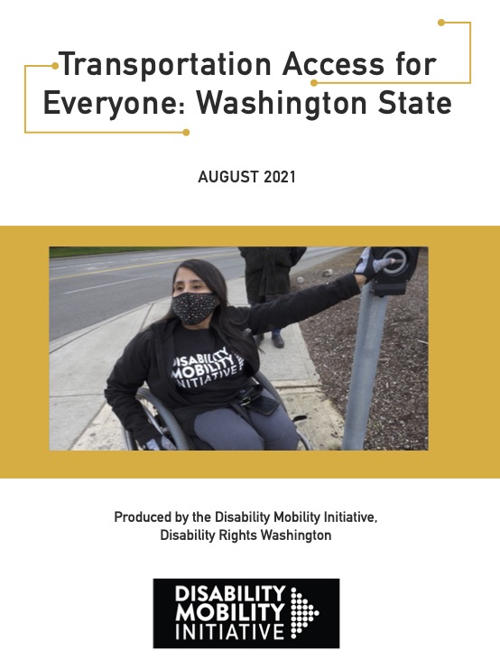
    Disability Rights Washington released a report this week that is so good it should be considered mandatory reading for everyone working in transportation in our state. The word “report” doesn’t really do it justice because “Transportation Access for Everyone: Washington State” is filled with personal stories from people all over the state who are being left behind or seriously inconvenienced daily by our transportation infrastructure and services. The report then summarizes some of the issues people face and provides a non-exhaustive list of recommendations for politicians, transportation departments and transit agencies.

    But even if you aren’t a politician or transportation staffer, the personal stories are very compelling. The term “disability” covers such a wide range of lived experiences, and the barriers people face are often caused by a lack of consideration in planning and implementation of policies, priorities, services and infrastructure design. Simply following the bare minimum to meet the Americans with Disabilities Act legal requirements is not good enough. Earmarking some funding for paratransit in a budget overflowing with highway spending is not good enough, either. Instead, we should work towards “radical inclusion,” which means being familiar with and serving as many people’s needs as possible. From the report authors:

    We did not intend to create an exhaustive list of the needs of transit-reliant disabled people or a complete set of policy recommendations. Instead, this report should
    be viewed as a starting point for policy- makers, elected officials, transit agencies, transportation departments, transportation advocates and civil and transportation engineers, and those in related fields, to humbly perceive their ignorance of the daily experiences of people who live differently than them and understand the urgent need for “radical” inclusion of disabled nondrivers in the planning processes across every level of our transportation systems and to begin, with urgency, to practice that inclusion.

    While the report has a lot of recommendations, it makes two “major actions”:

    • Shift resources to prioritize funding accessible pedestrian infrastructure and reliable transit service.
    • Look to nondrivers as transportation decision makers and experts.

    Big thanks to Disability Rights Washington and its Disability Mobility Initiative, led by Anna Zivarts, for this report. Thanks also to the more than 125 disabled nondrivers who shared their stories with the report’s authors. Check it out here.

    — Advertisement —
  • Decades-long private encroachment along Burke-Gilman Trail finally cleared to make small lakeside park

    Before and after photos showing the new lake view from the trail.
    Images courtesy of Stuart Strand.

    For decades, a small public space along the Burke-Gilman Trail just north of the Seattle city limit has been hidden behind a private fence. But no more.

    It took a remarkable amount of work to open this small space. Volunteers on a county advisory committee learned about the illegal fence and other private structures a decade ago when King County was preparing for its major 2011 remake of the trail from the Seattle border to Log Boom Park in Kenmore. Those volunteers — including Stuart Strand, who alerted me to the project and sent the photos — urged the county to take action to reclaim the space, resulting in a court battle that ultimately went in King County’s favor.

    The space between the trail and Lake Washington just south of NE 151st Street became public property in the 1974 when the county acquired rights to the old railroad right of way from Burlington Northern. But it has been closed off from public access since 1979 when nearby property owners constructed a fence with a locked gate preventing public access to the space between the trail and the lake. They also built a shed and some stairs and maintained a lawn as though it were theirs.

    But it wasn’t theirs. It belonged to all of us, as King County argued in court (counter-claim PDF):

    “Plaintiffs have erected a fence across King County’s property, which blocks King County’s access to a portion of its property and prevents public enjoyment of a portion of that property.”

    (more…)

    — Advertisement —
  • Memorial ride for Max Kullaway August 29

    Max holding a bike frame.
    Max Kullaway. Photo from the event page.

    Expert bike builder Max Kullaway passed away earlier this month after a long battle with cancer. Kullaway was the force behind 333fab bicycles. For years Max made bicycles in a Fremont shop alongside Bill Davidson before he and his spouse Tarrell (formerly a Cascade Bicycle Club staffer) moved to California. I highly recommend reading this 2012 interview in The Bicycle Story.

    The morning after he passed away, the kid and I were listening to KEXP while biking to preschool, and the DJ read a long memorial note for Max. It was a reminder that a single life can touch so many others. We are sending our love to Tarrell and all Max’s loved ones.

    Seattle friends are hosting a ride August 29 in his memory. Details from the event page: (more…)

    — Advertisement —
  • Seattle Bicycle Advisory Board seeks 3 new members for pivotal term

    The Seattle Bicycle Advisory Board is seeking three new members to start two-year terms in the fall. This term will cover some very important decisions for Seattle’s transportation future, including development of the next big Seattle transportation levy likely headed to the 2024 ballot. Apply online by August 27.

    The volunteer board is purely advisory and does not have any direct authority, but their work does help the department of transportation craft planning documents and prioritize projects to some extent. This work is especially important in the run-up to a major levy because the department and city political leaders will be using these plans when setting the scope and funding priorities that will be sent to voters.

    No professional expertise or transportation planning experience is required. In fact, the most effective board members tend to be people with a desire to learn and a willingness to ask down-to-earth questions that engineers may not have fully considered. You just need to be a Seattle resident who wants to help the city increase bicycling and bicycle safety.

    The time commitment includes attending evening meetings the first Wednesday of every month as well as some time spent reading relevant documents or working with small task forces as needed. Meetings are currently held virtually online, but some day will go back to being in-person in Seattle City Hall or the Municipal Tower downtown. More details from SDOT: (more…)

    — Advertisement —
  • U.S. Bike Route System grows in southeast Washington

    Map of existing and proposed US Bike Routes in Washington.
    Existing and proposed U.S. Bike Routes in Washington (PDF).

    WSDOT has started four new U.S. Bicycle Routes in southeast Washington, establishing Clarkston along the Snake River and Tekoa along the Palouse to Cascades Trail as long-distance bike route nexuses.

    The US Bike Route system is a vision for a connected network of bicycle routes spanning the nation, making it easier to travel by bike and encouraging economic activity in communities off the beaten path. Being designated a USBR is largely symbolic, though there are hopes it will someday be much more than that. Official designation does make them “eligible for national and global promotion,” according to the WSDOT press release. It also allows the state to install official USBR signage. But it doesn’t mean USDOT is sending money to upgrade their bike facilities.

    The longest of the new stretches, USBR 81, connects Clarkston to Tekoa, passing through Pullman (and Washington State University) on the 104-mile segment. Riders can also take the alternative USBR 281 for a shorter route between Clarkston and Pullman. From Clarkston, just across the border from Lewiston, Idaho, people can head west on USBR 20, which will someday connect to the Tri-Cities, Kennewick and Columbia River routes toward Vancouver, Washington, and beyond. For now, it reaches Lewis and Clark Trail State Park about 77 miles west of the Idaho border.

    The shortest of the four new routes is a 2-mile stretch of USBR 40 between Tekoa and the Idaho border. But this route is also one of the most exciting because the bulk of the planned 400-mile route in Washington follows the car-free Palouse to Cascades Trail. Long stretches of this rail-trail are very remote and rough currently, but the state is investing to rehabilitate key trestles and bridges. This work is worth a post of its own, but the next year should be very exciting for this trail and the future USBR 40. So while the USBR designation is not exactly a source of revenue, it does help add to the list of reasons the state should invest in them.

    Washington State added its first route to the national network in 2014 with much fanfare. USBR 10 crosses the state along US Highway 20. The national network is also building out slowly, though Washington’s neighboring states do yet not seem in much of a hurry to link up. Oregon does have its own Scenic Bikeways, though they are often loops or short segments and are not in the USBR System.

    More details from WSDOT: (more…)

    — Advertisement —
  • Watch: Searching for the 125-year-old Interlaken bike path

    In 1896, Seattle city crews and a group of volunteers worked together to build a bike path from downtown to Lake Washington. They made it quickly, following the terrain around the north end of Capitol Hill to find the easiest route. They cleared the skinny path and dug as needed to make it mostly flat, then they covered it with cinders and ash. For less than a decade, biking out on this path was a very popular activity, and it helped promote the city’s first major bike boom. But by 1905, most of the route had either vanished or was being developed into a boulevard.

    One of the most iconic sections was through what is now Interlaken Park. It was not unheard of for people to encounter a bear while biking through the deep woods of Interlaken, and much of the route of the old path was immortalized when the Olmsted Brothers used it as the guide for Interlaken Boulevard.

    But a path paved with ashes and often routed through private property did not last long. Property development closed some sections while nature took care of others. Still, I was curious if I could find any hints today that the old path ever existed. Jonathan, a Seattle Bike Blog reader, sent me an old hand-drawn plot city engineers used to construct the 1896 path. I traced that plot into a Google Map that I could follow on my phone, and then set out to follow it.

    Did I find the old path? Watch the video to find out.

    Old photo of a woman with a bike on a winding path.
    Woman with bicycle on the Lake Washington bicycle path, 1899-1900. Photo by John P. Soule.
    — Advertisement —
— Advertisement —

Join the Seattle Bike Blog Supporters

As a supporter, you help power independent bike news in the Seattle area. Please consider supporting the site financially starting at $5 per month:

Latest stories

— Advertisements —

Latest on Mastodon

Loading Mastodon feed…